Capsule Houses in Scenic Areas: Project Models
Five workable project models for capsule houses in scenic areas - viewpoint, forest, lakeside, upland and attraction-adjacent - with terrain fit and risks.
Scenic-area projects are the most common enquiry and the most variable in form. The same unit can be the centrepiece of a viewpoint, one of forty in a forest, or a low-impact addition to an existing attraction - and those are three different projects with three different risk profiles. This page catalogues five workable patterns, sets out what each requires of the land, and explains the land-use judgement common to all of them.
The Land-Use Question That Governs Everything
Before choosing a pattern, three questions determine whether a scenic site is viable at all.
- What is the land classified as, and does that classification permit overnight accommodation or only day use?
- What construction intensity is permitted - footprint, height, coverage, and whether permanent foundations are allowed?
- How reversible does the intervention need to be? In sensitive or protected landscapes, the ability to remove the structures without lasting ground disturbance is often the argument that wins approval.
Factory-built units placed on minimal ground works and small foundations have a genuine advantage here: the reversibility argument is credible in a way it is not for a concrete building. But it is an argument to be made with drawings and a method statement, not an assumption. Requirements may vary by market and applicable land-use regulation; confirm with the relevant authority.
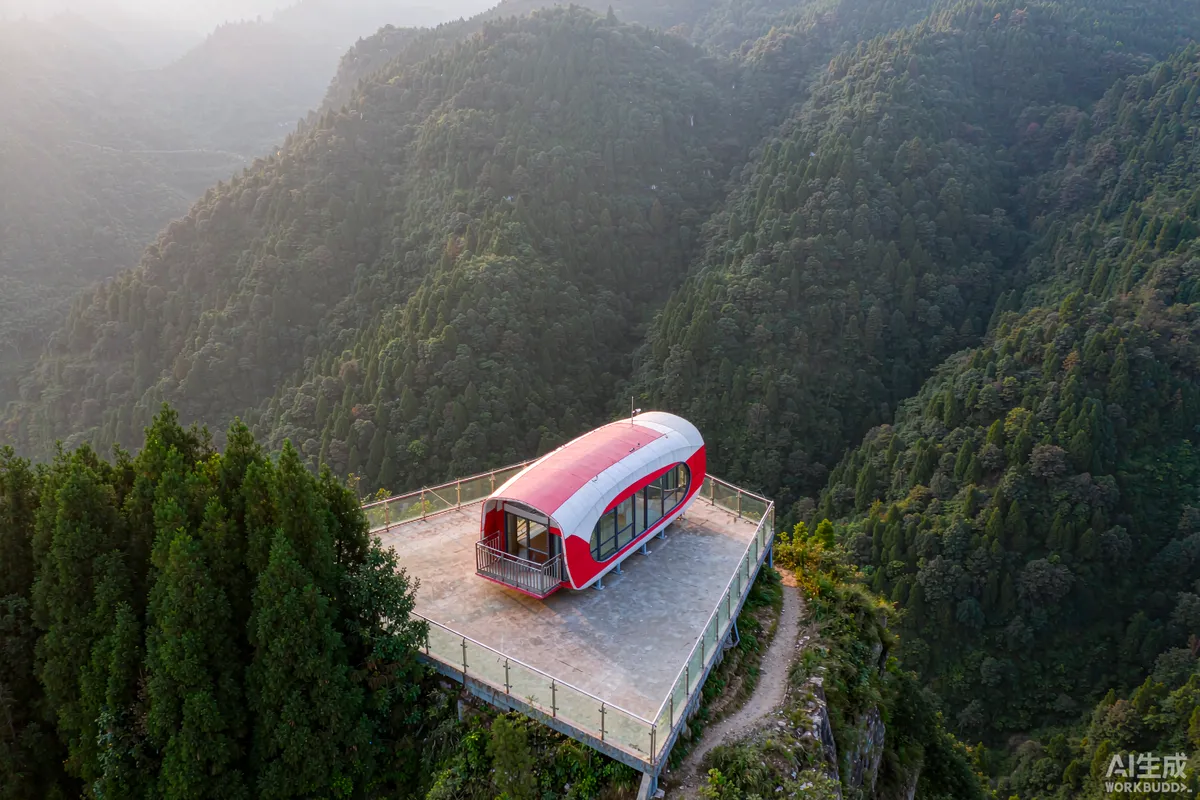
Model 1: Viewpoint and Cliff-Edge Platform
The high-impact, low-count pattern. Few units, dramatic position, premium rate.
- Terrain: clifftops, escarpments, ridges, canyon rims - anywhere with a defined outlook.
- Typical scale: one to six units.
- Circulation: a single approach route, usually sharing an existing viewpoint or trail; service access is the hard part.
- Main risks: geotechnical stability, wind exposure, emergency access, and the visual impact of the structure on the very view being sold.
- Pricing logic: highest rate in the portfolio, sold on position rather than on space.
The engineering burden sits in the ground and in the access, not in the unit. Budget accordingly, and treat the geotechnical assessment as a first-stage cost rather than a contingency.
Model 2: Forest-Scattered Units
The highest-capacity pattern and the one that reads most naturally in landscape.
- Terrain: woodland and plantation on gentle to moderate slope.
- Typical scale: eight to forty units.
- Circulation: a loop or spine path with short spurs; keeping vehicles at the edge is what preserves the experience.
- Main risks: tree loss and root protection, drainage on a slope, fire safety and defensible space, and wayfinding after dark.
- Pricing logic: mid-market, sold on privacy and immersion; occupancy can run year-round where the climate allows.
Where fire risk is part of the local picture, the spacing and vegetation management plan should be settled at layout stage. Our article on wildfire and defensible space covers that work.
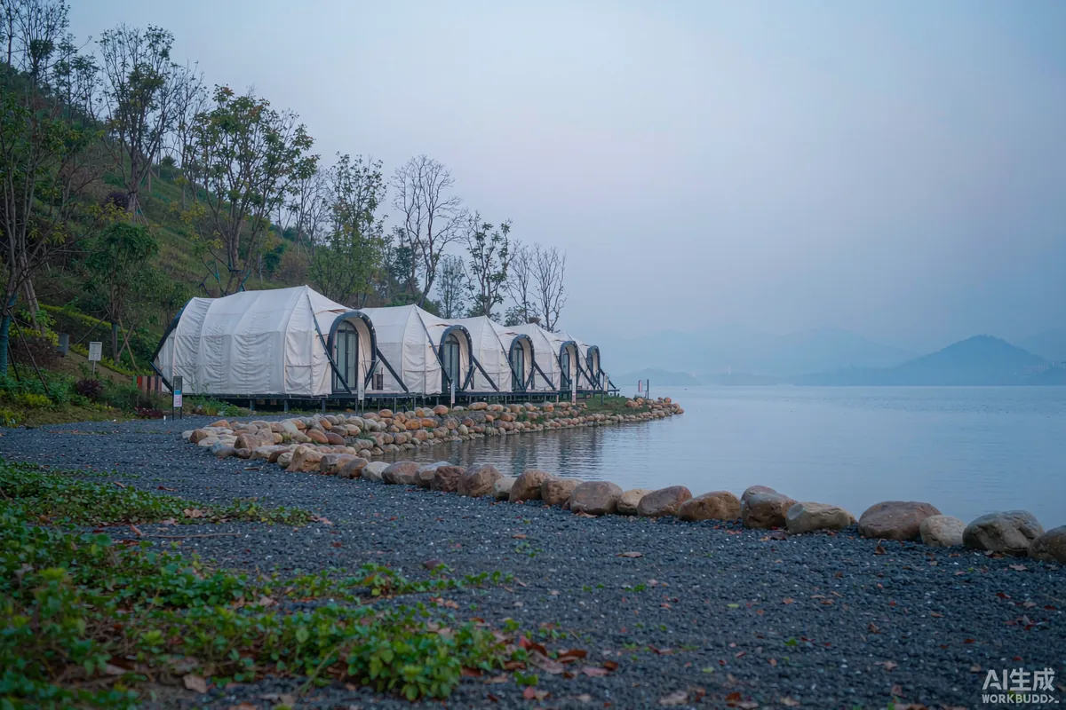
Model 3: Lakeside and Water-Edge
Strong commercial performance, concentrated technical difficulty.
- Terrain: lake shores, reservoirs, slow rivers, and sheltered coastal inlets.
- Typical scale: four to twenty units.
- Circulation: a shore-parallel route, with units set back far enough to keep the bank intact.
- Main risks: flood and seasonal water level, bank stability, drainage and wastewater disposal near water, and setback rules that are usually stricter than elsewhere.
- Pricing logic: premium, with strong shoulder-season demand where the water is the draw.
Wastewater is the constraint that most often reduces unit count on water-edge sites, and it should be resolved before the layout is fixed rather than after.
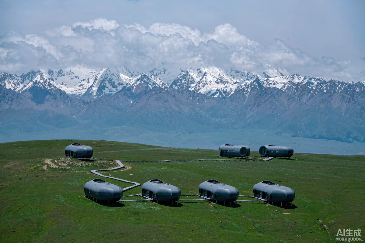
Model 4: Upland and High-Altitude
Small counts, distinctive product, demanding specification.
- Terrain: plateaus, mountain pastures, ski-adjacent land.
- Typical scale: two to twelve units.
- Circulation: heavily seasonal; winter access often determines whether the project is year-round or not.
- Main risks: snow and wind loading, freeze protection, access closure, and a short operating season.
- Pricing logic: high rate against a short season; the model depends on achieving rate rather than occupancy.
Specification for altitude - thermal performance, glazing, snow load and freeze protection - is covered in our article on high-altitude site considerations.
Model 4b: Seasonal and Event-Led Deployment
A variant worth separating, because the commercial logic is different from the four above.
- Terrain: event grounds, festival sites, seasonal viewpoints - often land used for something else most of the year.
- Typical scale: six to thirty units, deployed for weeks rather than years.
- Circulation: high intensity over a short period; servicing and waste handling dominate the design.
- Main risks: consent for temporary use, ground protection and reinstatement, and very high peak loads on water and power.
- Pricing logic: priced against the event, with a short payback window and a defined removal plan.
The transportable nature of the format is the point here: units can be removed and the ground reinstated, which is frequently the condition on which consent is granted.
Model 5: Adjacent to an Existing Attraction
The lowest-risk commercial pattern: accommodation added to a site that already has visitors.
- Terrain: whatever the host site has, usually already serviced.
- Typical scale: four to twenty units, phased.
- Circulation: existing; the work is in separating guest and service traffic.
- Main risks: land-use consent for a change of use, capacity of existing utilities, and the operational question of whether the host can run accommodation.
- Pricing logic: tied to the attraction's own pricing; often the easiest occupancy in the portfolio.
Because demand already exists, this is the pattern where phasing works best: a small first phase proves the operating model before land is committed to more units.
Phasing a Scenic Project
Scenic sites almost always reward a phased approach, and the reason is informational rather than financial: the first phase tells you what the second should be.
- Size phase one to be independently operable. It must include whatever is needed to receive guests - access, a check-in arrangement, utilities and housekeeping - not merely the units.
- Use phase one to test the rate. A scenic site's achievable nightly rate is an assumption until it is booked, and the first season is the cheapest way to test it.
- Keep the phase boundary on the service routes. Later phases should be able to connect to the infrastructure built for the first.
- Do not commit land to later phases in the first consent application unless there is a reason to. A smaller application is usually a faster one, and it can be extended.
- Record what the first season teaches before designing phase two, particularly about noise, temperature and access - the three themes that recur in guest feedback.
What to Put in the Submission
Applications for sensitive locations are decided on the quality of the submission as much as on the merits of the proposal. Four elements carry most of the weight.
- A visual impact statement showing the proposal from the viewpoints that matter - usually the approach road, the water, and any public trail.
- A reversibility statement describing how the structures would be removed and the ground reinstated, with the method rather than the intention.
- A services statement covering water supply, wastewater treatment and disposal, power generation and storage, and waste handling.
- An access and construction statement covering the route, the vehicle types, the duration and the ground protection measures.
Where an ecological or heritage assessment is required, commission it early. It is usually the longest lead item and it frequently changes the layout, which is a cheaper discovery before submission than after.
Choosing Between the Models
| Model | Choose it when | Avoid it when |
|---|---|---|
| Viewpoint | You have a single exceptional position and can fund the ground works | Access or geotechnics are unresolved |
| Forest-scattered | You have area, tree cover and a need for volume | Fire risk or drainage cannot be managed |
| Water-edge | Wastewater and setback can be solved | Flood levels or bank stability are uncertain |
| Upland | You can achieve a high rate over a short season | Winter access cannot be guaranteed |
| Attraction-adjacent | Visitor flow already exists and utilities have capacity | Change of use is unlikely to be permitted |
Construction method in sensitive landscape - access, ground protection and sequencing - is covered in our article on low-impact eco-tourism. Site assessment method is in site selection and land evaluation, and the consent process in permits and zoning. To discuss which pattern fits a particular site, send us the location and land classification.
More from the Blog
Capsule Home Cost Guide: What You Really Pay in 2026
EXW, shipping, install and the hidden line items — a transparent breakdown of total landed cost.
Read article →
How to Install a Capsule Home in 3 Days: A Step-by-Step Guide
From site prep to first guest — the exact sequence our install crews follow on every deployment.
Read article →
Real Owners, Real Numbers: Success Stories
How a lakeside resort, a Spanish glamping site and a Singapore dealer hit their targets.
Read stories →Talk to the Factory
Ready to Ride the 2026 Wave?
Get the latest catalog, pricing tiers and a layout sketch for your land — straight from the engineering team.